By Kendra Collins, New England Regional Science Coordinator
Winter is often a quieter time for those of us working with American chestnuts. It is also a great time to start planning and preparing for the busy field season ahead. The arrival of spring often seems to catch us wishing we had spent more of those calm winter days getting ready to hit the ground running. TACF’s on-line database, dentataBase, has some great tools available to help you get your spring chestnut plans laid out.
Tracking Harvest Data
In the fall there is often a mad rush to harvest chestnut trees, shuck burs, and store nuts in preparation for spring planting. Many of the notes on crosses or trees harvested, or the numbers of nuts collected, end up on scraps of paper or handwritten data sheets and stuffed into folders or stacks on our desks. A great way to get better prepared for spring planting is to get those crosses and harvest totals entered into dentataBase. Not only does this help ensure important data are not lost, but it allows for easy sharing of those data with others in your Chapter, or with TACF’s science staff. No need to dig through emails, spreadsheets, or stacks of notes – the crosses and harvest totals are available through dentataBase any time.
Planting Planning
Creating plantings in dentataBase can take a little practice, but is a great way to allocate nuts to appropriate planting sites and lay out any specifics to the planting design. Plantings in dentataBase can be viewed by Chapter science coordinators, orchard managers, or TACF Regional Science Coordinators, helping to ensure everyone knows what is planned or can identify any issues or questions before planting. Designed plantings can be edited any time before providing dentataBase a planting date.
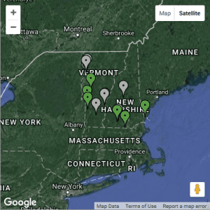
The map on the Chapter’s home page shows parcels where chestnut plantings exist. Those in green identify accurate public locations that someone interested in chestnut could visit, while those in gray identify sites on private land where permission would be needed before visiting. Sites on private lands do not display in their exact location, but rather show up at random within a 10-mile radius of the true location. (Photo, screen grab from dentataBase.)
Distributing Chestnuts
Not every chestnut harvested is destined to be used in a planting that you are involved with. You may provide a small number of nuts to a school for educational use or a researcher with an important project. Tracking these distributions is possible using dentataBase. Entering distributions helps us all keep track of how many nuts from a given cross are actually still available, as well as who received nuts from that cross, should questions arise in the future.
Identifying Public Plantings and Wild Trees
Often our members, or even the general public, want to know where they can see chestnut plantings or trees. While it can be exciting and rewarding to share chestnuts with others, we take the privacy of our orchard managers and those submitting wild tree reports very seriously and tag all planting sites and reported trees as “public” or “private” as part of entering them into dentataBase. Using the Parcels or Wild Tree maps in dentataBase you can quickly and easily identify public sites that could be shared.
For more information about using dentataBase please contact your Regional Science Coordinator with questions or to find a time for training. dentataBase is still in development and may not be appropriate for use by all TACF members at this time, however if you think you might benefit from this tool please don’t hesitate to reach out.